

Billy Friebele
Assistant Professor of Art, St. Mary’s College of Maryland
There is an invisible layer of infrastructure orbiting above that is barely perceptible to the naked human eye, save for clear nights when these devices are near perigee. [1] Since the first successful satellite, Sputnik 1 (1957), more than 6,000 satellites have been launched, and approximately 3,600 remain in orbit. [2] There are currently more than 21,000 objects larger than 10 cm orbiting the Earth. [3] Within this revolving cloud of matter lies a hidden network of omniscient prosthetic eyes peering down on us from above.
For centuries, humans have looked to the sky to orient themselves. Early priest astronomers observed rhythms of the stars to ascertain the most fruitful times to plant crops. Civilizations around the world incorporated celestial positioning into structures such as the Egyptian pyramids, Mayan temples, and Stonehenge. The sky has been utilized as a counterpoint to the horizontal axis, a point of triangulation, which allows us to extend our line of site and position ourselves relative to the landscape. [4]
The Global Positioning System (GPS) can accurately indicate time, position and velocity at any point on earth. This is accomplished by deploying 21 evenly spaced satellites on a 12-hour rotation at 55 degrees to the equator. At minimum there are always four GPS satellites overhead, 24-hours a day. [5] Concurrently a proliferation of high-resolution satellite images has been made possible by advances in the quality of digital cameras in space.
The view from above is not new. Maps have always presented an aerial depiction of the world, but the ability to position ourselves precisely, to track our movements in real time, and to view remote locations around the world from above are developments that bear further investigation.
Satellites augment human vision; they allow us to see from a position of privilege and to locate ourselves in space. Through the screen we virtually inhabit the satellite, peering from on high. Online databases of satellite imagery allow visual access to public and private spaces across the globe from physically remote locations, reinforcing the panoptic sense that we are under constant surveillance. [6]
Donna Haraway has warned of the “god trick of seeing everything from nowhere.” [7] The satellite view is a distortion, a spherical, three-dimensional space collapsed into two-dimensional mosaics of stitched photographs. Haraway refuses this flattened view, advocating for situated experience in which knowledge is not the disembodied, ‘objective’ view from above, but grounded in the physical experience of the subjective body. [8]
I agree with Haraway that we should not unquestioningly accept the myth of the objectivity of satellite vision. With that in mind, we should take up this tool with full knowledge of its political, social, and militaristic influence. This equipment can be hacked, or intentionally misused in order to reach alternative results.
Fig. 1: Walking as Drawing: Washington, DC, 2011, Billy Friebele, Digital Print & Animation, ©Billy Friebele
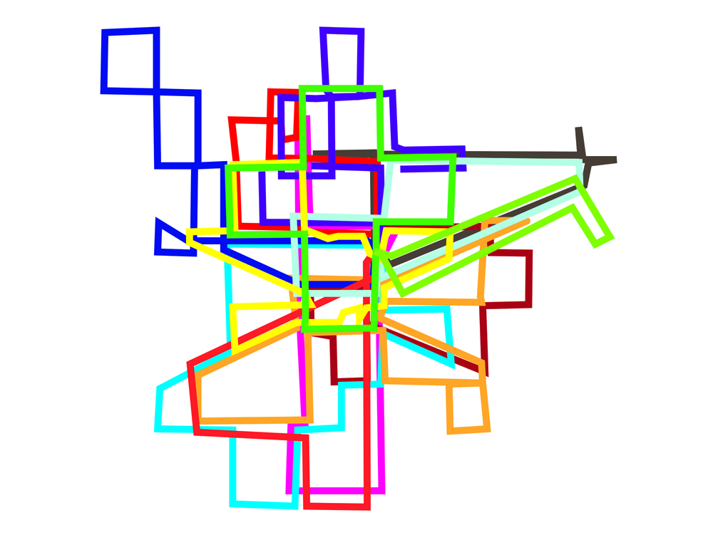
Fig. 2. Walking as Drawing: Washington, DC, 2011, Billy Friebele, Digital Print & Animation, ©Billy Friebele
Over the last three years I have executed the Walking as Drawing project in various cities around the world in an effort to more fully understand the relationship between the ‘view from nowhere’ of the satellite and the ‘situated knowledge’ experience of embodied navigation. [9] This is a participatory project, involving groups of volunteers who are given the conceptual instructions: “Walk within a boundary for a set amount of time, thinking of your path as a drawing.” They use GPS devices to record their paths or draw on maps that I create from satellite imagery. These paths are later combined into animations and graphic images. The directive, to think of a path as a drawing, asks participants to explore their surroundings counter to patterns established by habit and routine (commerce), and to visit areas they would otherwise have no reason to.
This process emphasizes a direct encounter with one’s physical surroundings and the spatiotemporal aspect of traversing space rather than distinct destinations. Simultaneously, participants have the option of either tracking their movements with GPS devices or by drawing lines onto aerial photographs, thereby mentally inhabiting the prosthetic eye of the orbiting satellite.
Mary Flanagan addresses this balancing act between positions by stating that, “knowledge in virtual space is always negotiated as a product (a very political product) of a located and a roaming subjectivity. Hyperknowledge is created within this third space, in the relationship between virtual body and the physical.” [10] While the term “virtual” can be understood to indicate an immersive experience (virtual reality), there is also an inherent quality of simulation implied, as realistic visual experiences are recreated and presented on the computer (virtual worlds). I would like to make the case that the satellite view is a simulation, or an abstraction of physical space, because it is an aerial flattened simulation of three-dimensional space presented on a screen. For Mary Flanagan it is the synthesis of virtual and physical embodiment that creates the conditions for a hybrid understanding of positioning and perception. It is only by establishing a fluid movement between the subjective body and the aerial satellite view that we can maintain a critical position towards both loci.

Fig. 3. Walking as Drawing: Cuzco, Peru, 2011, Billy Friebele, Digital Print & Animation, ©Billy Friebele

Fig. 4. Walking as Drawing: Cuzco, Peru, 2011, Billy Friebele, Digital Print & Animation, ©Billy Friebele
One of the recurring comments I heard from participants in multiple cities was about the experience of charting a path based on the satellite view, and then being confronted by an experience on the street, which caused a swerve. [11] For instance, when walking in the Wynwood neighborhood of Miami, FL, participants remarked that their walks were dictated to a large degree by a sense of fear. Students walking in Cusco, Peru reported a similar experience. The free-roaming aerial view leads us to believe we can explore at will, and that all spaces are equally accessible, but embodied situated knowledge reinforces our socio-political-cultural limitations. In short, it reemphasizes the body. The directive to “think of your path as a drawing” first alters participants’ movements by emphasizing the path rather than the destination, which leads to a more embodied sense of traversing space, and second asks them to consider this movement from a disembodied position of the satellite. These conflicting actions point to hyperknowledge as a product of two simultaneous experiences, encouraging awareness of the aerial in parallel with embodied exploration. Mary Flanagan calls this “double consciousness: the class, race, and gender identity of the user’s physical body, as well as the virtual (bodies) of the character he or she ‘becomes’; when we ‘look’ at a screen.” [12]

Fig. 5 Walking as Drawing: Miami, FL, 2011, Billy Friebele, Digital Print & Animation, ©Billy Friebele
In the satellite era we are seldom lost. We can appeal for directions from a robotic voice, pinpoint our current location, and view aerial as well as street-level photographs of our destinations. Following the conceptual instructions for this project leads participants to consider the value of getting lost, not only spatially, but also temporally, similar to Situationist practices of psychogeography and the dérive. While maps were utilized in dérives, the goal was always more in line with Donna Haraway’s call for embodied situated knowledge. In a dérive persons “let themselves be drawn by the attractions of the terrain and the encounters they find there.” [13] The introduction of GPS allows us to simultaneously hover above ourselves while experiencing the city in a new way. The emergence of locative media practices have taken advantage of this technological ability to map, locate, and collaboratively build alternative spatial representations of our surroundings. Many locative projects connect participants through their interactions with the city via social networks, mapping apps, and software, but this project asks participants to meet one another in person, to begin the project and also to discuss their experiences at the conclusion of their walks. This adds a layer of shared awareness. Not only does the project lead participants to a state of hyperknowledge of their personal experience of the landscape; they are also aware of all other members of the group exploring the matrix of streets together.

Fig. 6 Walking as Drawing: Jatiwangi, Indonesia, 2011, Billy Friebele, Digital Print & Animation, ©Billy Friebele
Deploying this project with the Jatiwangi Art Factory in a small predominantly Muslim village in West Java, Indonesia, elucidated this idea. In discussing their walks, several participants commented that this was the first time they had ever walked in the village because motorcycles are the preferred mode of transportation. Walking is simply not a dominant practice there. During the walk they frequently ran into each other, which later led them to make an effort to explore a wider territory. Interestingly, female participants pushed the boundaries of the map the furthest, using the instructions as a way to test the limits of their spatial confines. Perhaps this project led them to areas of the city that would otherwise fall outside of their predetermined cultural territory.
Fig. 7. Walking as Drawing: Amsterdam, NL, 2013, Billy Friebele, Digital Print & Animation, ©Billy Friebele
This project leads me to an understanding of the city as a collection of flows. As Mary Flanagan observes, “The agency of navigation, situated in multiple subjectivities, offers an alternative epistemological model.” [14] This conception of knowledge is “multiple, heterogeneous, and conflicted…truth is both embodied and disembodied or multiple-bodied…it operates in many space/time planes, and it is produced by single and multiple individuals with various cultural, gender, class, and ethnic backgrounds.” [15]
The results of these multi-authored excursions are graphic images of walks superimposed over satellite maps. The lines are animated simultaneously; they overlap and scurry through the patterns of the streets, until looping back to the departure point. The map fades out. The image is of a collection of routes chosen within a network of passageways. The linear forms mirror the ideological construction of the city: the dominant grid of efficiency in New York, NY; the concentric rings of outward growth in Santa Cruz, Bolivia; the Incan cardinal direction streets of Cuzco, Peru. What do these drawings reveal? Ultimately they are only snapshots, a small cross-section of the city, a one-hour slice of shared exploration. The project recognizes its shortcomings in offering a totalizing view of the city, which is the goal and hunger of the prosthetic satellite vision from nowhere. Instead it is a collection of multiple subjective traces, a public art project that only a small set of participants were aware of, a segment of time spent breaking routine behavior, through a hybrid positioning from above and below, simultaneously.

Fig. 8. Walking as Drawing, 2012, Billy Friebele, Video Installation, ©Billy Friebele
References
1. David Dickinson’s article in Universe Today, “How to Spot and Track Satellites”, July 11, 2013, accessed January 23, 2014, http://www.universetoday.com/103382/how-to-spot-and-track-satellites/.
2. David Rising “Satellite hits Atlantic – but what about the next one?” Seattle Times, Nov 11, 2013, html (Accessed February 2, 2014, http://seattletimes.com/html/nationworld/2022236028_apxfallingsatellite.
3. Fraser Cain’s article in Universe Today, “How Many Satellites are in Space?”, Oct 24, 2013, accessed Jan 20, 2014, http://www.universetoday.com/42198/how-many-satellites-in-space/#ixzz2onOQpvgU
4. B. Hoffman-Wellenhof, H. Lichtenegger, and J. Collins, Global Positioning Theory and Practice. (New York, NY: Springer-Verlag Wien, 1992), 1.
5. Hoffman-Wellenhof, Lichtenegger and Collins, 4.
6. Michel Foucault, Discipline and Punish: the Birth of the Prison (New York: Random House, 1975).
7. Donna Haraway “Situated Knowledges: The Science Question in Feminism and the Privilege of Partial Perspective,” Feminist Studies 14, no. 3 (Autumn, 1988) 589.
8. Haraway 589.
9. Billy Friebele’s official Web Site, “Walking as Drawing,” accessed Feb 20, 2014, http://www.billyfriebele.com/walking.html
10. Mary Flanagan “Hyperbodies, Hyperknowledge: Women in Games, Women in Cyberpunk, and Strategies of Resistance,” in RELOAD: rethinking women + cyberculture, ed. Mary Flanagan and Austin Booth (Cambridge, MA, US: The MIT Press, 2002), 440-441.
11. Louis Althusser Philosophy of the Encounter: Later Writings, 1978-1987, trans. and ed. G.M. Goshgarian (London/New York: Verso, 2006).
12. Flanagan 441.
13. Guy Debord “Introduction to a Critique of Urban Geography,” Les Lèvres Nues 6, trans. Ken Knabb (Paris: September 1955).
14. Flanagan 441.
15. Flanagan 437.
Bio
Billy Friebele lives and works in Washington, DC. He received a Masters in Fine Arts in from the Maryland Institute College of Art and a Bachelors of Arts in Philosophy from St. Mary’s College of Maryland. His work examines the intersection of new media and public space through video, animation, and installation. Billy has exhibited at the Baltimore Museum of Art, the Orlando Museum of Art, and the Art Museum of the Americas in Washington, DC. He has also recently exhibited in Sarajevo, Bosnia; Jatiwangi, Indonesia; Detroit, Michigan; Boston, Massachusetts; and St. Louis, Missouri, among other places. He teaches as an Assistant Professor of Digital Media at St. Mary’s College of Maryland.
www.billyfriebele.com